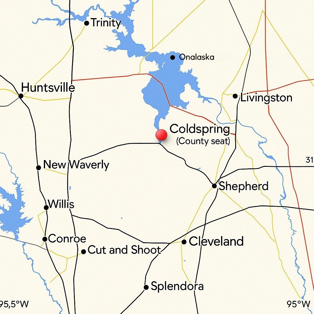
Geographic Orientation of San Jacinto County, Texas
San Jacinto County is located in southeastern Texas. It is surrounded by nearby towns, natural features, and key transportation routes. The county seat, Coldspring, lies near the center of the map and has long served as a local reference point.
Surrounding Communities
To the northwest, Huntsville stands out as a significant regional hub. It has influenced the area through education and state institutions.
To the northeast, the towns of Onalaska and Livingston are situated near Lake Livingston. This reservoir has shaped recreational use and ecological development along the county’s eastern edge.
South and southeast of San Jacinto County lie Shepherd, Cleveland, and Splendora. These towns connect to the county via regional highways and shared economic ties.
To the west, towns like New Waverly, Willis, and Conroe belong to nearby Montgomery County. These communities have historically maintained transportation and trade links with San Jacinto County.
Natural Landmarks
Lake Livingston appears as a large, blue area on the eastern side of the map. It remains one of the most prominent natural features in the region. The lake has impacted nearby settlement, recreation, and land development since its formation.
Other wooded areas and water systems supported early farming, livestock, and timber activity. These natural features also influenced where early communities and churches were built.
Road Networks
Red and black lines on the map show highways and secondary roads. These routes follow patterns established during the county’s early development. Roads connecting towns like Coldspring, Shepherd, and Cleveland reflect traditional paths used for trade, travel, and communication.
Access to Cleveland and Conroe provided links to railroads and larger markets in earlier decades. These routes also helped support the agricultural and logging industries.
Central Role of Coldspring
Coldspring, the county seat, appears marked near the center of the map. It has long served as the administrative center for San Jacinto County. Historically, it hosted the courthouse and central offices. The town also acted as a common point for public gatherings and legal affairs.
Regional Context
The map gives a broader view of how San Jacinto County connects to surrounding regions. Neighboring counties, roadways, and towns help tell the story of movement, trade, and local development over time.
Understanding these spatial relationships helps explain the county’s role in southeastern Texas. It also provides context for exploring its cemeteries, churches, and other historical records.