The Formation of Modern San Jacinto County, Texas
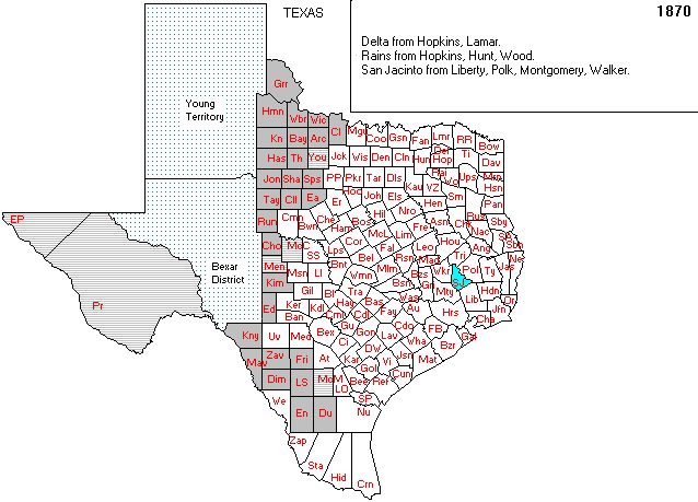
In 1870, San Jacinto County emerged as a new administrative division in East Texas. Lawmakers created it by redrawing boundaries from Liberty, Polk, Montgomery, and Walker Counties. This change addressed the growing need for local governance as rural populations increased.
Historical Background
The 1870 map highlights San Jacinto County in green, surrounded by red-outlined counties. This visual shows how the county separated from its neighbors. At that time, many counties in Texas were still adjusting their borders. Communities often requested new boundaries to improve access to courts, schools, and local services.
People living far from existing county seats often faced challenges. By forming smaller counties, residents gained better representation and shorter travel distances for civic needs.
Regional Context
San Jacinto County’s location placed it at the intersection of several existing regions. It included parts of farmed land, roadways, and developing towns. These inherited features allowed the county to operate effectively from the start.
Similar changes occurred elsewhere in Texas. As settlers moved into new areas, they called for changes in county organization. San Jacinto County became part of this broader trend toward responsive local governance.
Importance of the Map
The 1870 boundary map documents this moment of administrative reorganization. It clearly shows the shape of the newly formed county. More importantly, it reflects how population growth and geography influenced political boundaries.
Maps like this one offer more than visual information. They also preserve the choices communities made to define their space and structure. In San Jacinto County’s case, the map marks the beginning of a new civic identity—one shaped by land, people, and the need for self-governance.
Continued Relevance
Even today, the borders established in 1870 still define the region. While the county has changed in many ways, its foundation remains rooted in this early decision. Understanding this formation helps explain how local institutions developed and why certain boundaries still matter.